

Kamchatka Krai Profile
LOCATION & GEOGRAPHY
The Kamchatka Peninsula forms the majority of the krai's territory, separating the Sea of Okhotsk and the Bering Sea in the Pacific Ocean. It is bordered by Magadan Oblast to the west and Chukotka to the north. Kamchatka Krai is an active volcanic zone which is home to Kluchevskaya, the largest volcano in Eurasia, and the Decade Volcanoes of Avachinsky and Koryaksky. In general, there are about 300 large and medium-sized volcanoes, 29 of them are active. The region’s economy is based on fishing industry (fishing and seafood processing), agriculture, production of natural gas, coal, non-ferrous metals, electric power industry (including the development of non-conventional geothermal energy), tourism. Kamchatka krai has only three cities: Petropavlovsk-Kamchatsky (with population of 181,000), Yelizovo (39,000) and Vilyuchinsk (22,000). CAPITAL: Petropavlovsk-Kamchatsky (settled in 1740, population 181,181 people in 2019,
the city is located 6,766 km (4,204 mi) from Moscow and about 2,220 km (1,380 mi) from Vladivostok.)
POPULATION & NATIONALITIES: 314,723 as for 2019, the 76th in Russia by population, ethnic groups according to 2010 National Census: Russians – 85.9%, Ukrainians – 3.9%, Koryaks – 2.3%, Itelmens – 0.8%, Tatars – 0.8%, Belarusians – 0.7%, Others – 5%.
CLIMATE
The climate is subarctic in the northern part of the region, temperate maritime, monsoon - on the coast and continental - in the interior districts. Winters are long and snowy, the average temperatures in January and February range from minus 7-8 degrees Celsius in the south and south-east, minus 10-12 degrees Co in the west, to minus 19-24 degrees Co 
in the center and north.Summers are short, usually cool and rainy, the average temperatures in July and August range from plus 10-12 degrees Celsius in the west and the south-east, to plus 16 degrees Co in the central part. HISTORY The first people inhabited Kamchatka in the early Neolithic. Since the Stone Age, the tribes of Koryak, Itelmen and Ainu settled in this territory. The total population mainly engaged in hunting and fishing was sparse. In the 17th century, Russians began to explore Siberia and the Far East. In the 1730s, permanent Russian population appeared and because of its scarcity it largely mixed with the natives. In 1849, Kamchatka oblast (region) was formed with the center in the town of Petropavlovsk port (present Petropavlovsk-Kamchatsky). Later in 1909, Kamchatka guberniya (province) was formed. In 1932, Kamchatka oblast was established as part of Khabarovsk krai. In 1956, Kamchatka became an independent region. Koryak Autonomous Okrug was located on its territory and in 2005 a referendum on the unification of Kamchatka oblast and Koryak Autonomous Okrug was held. In 2007, a new federal subject of Russia appeared - Kamchatka krai. 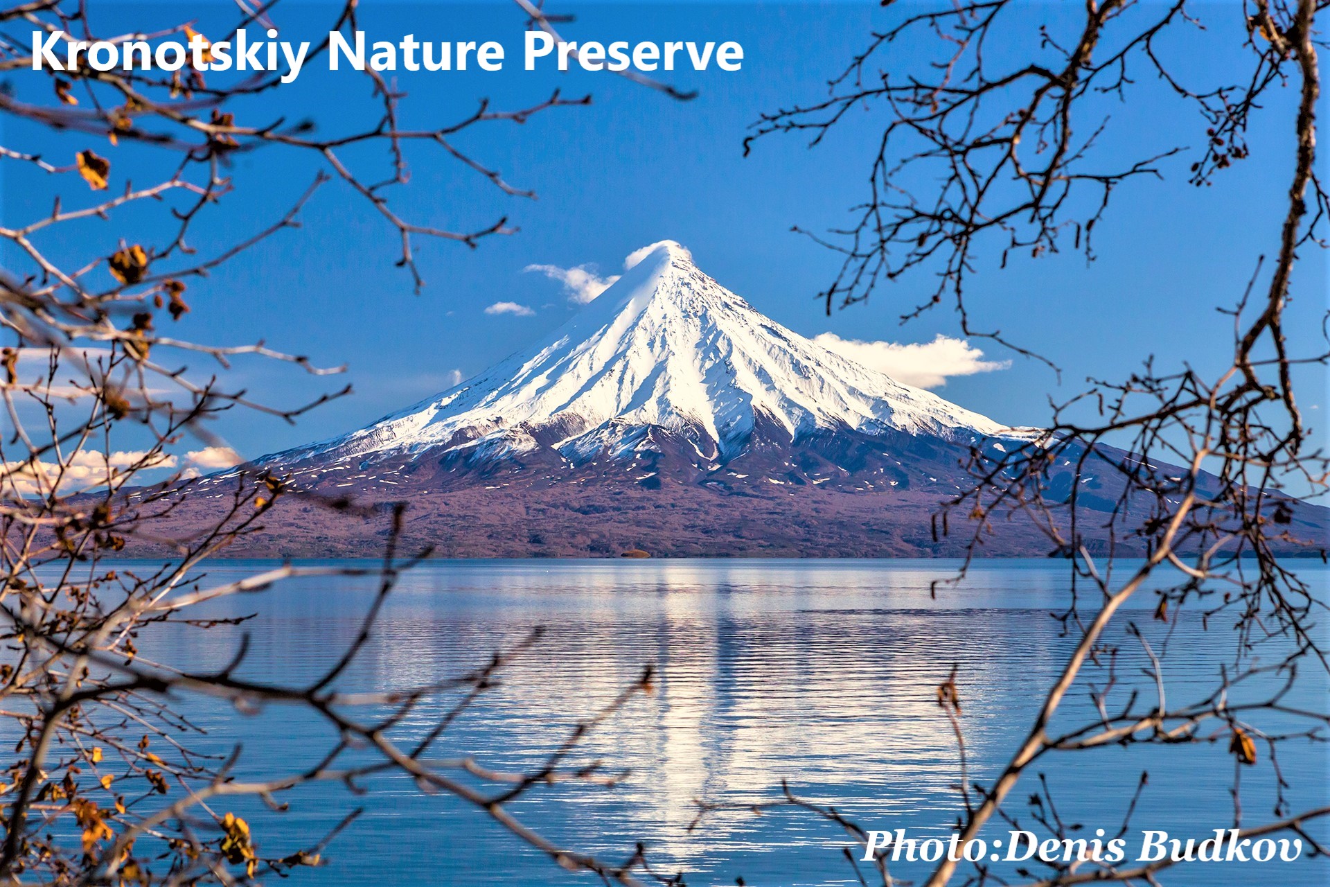 NATURE PRESERVES / WILDLIFE SANCTURIES NATURE PRESERVES / WILDLIFE SANCTURIES More than 14.5% of Kamchatka krai refers to specially protected natural areas. The six zones called “Volcanoes of Kamchatka” are included in the UNESCO World Heritage List: the Kronotsky Biosphere Reserve, the caldera of Uzon volcano, Bystrinsky Natural Park, Natural Park Nalychevo, South Kamchatka Nature Park, Klyuchevskoy Nature Park. The Kronotsky Biosphere Reserve
Area 1,183,662 hectares (including 135,000 hectares of the Pacific Ocean) (11,837 km2; 4,570 sq mi) Location: 230 km away of Petropavlovsk-Kamchatsky, on the coast of Kamchatka Peninsula
In the Kronotsky Nature Reserve, landscapes and biological diversity of Eastern and Central Kamchatka remain in their original form. Here is the famous Valley of Geysers - one of the largest geyser fields in the world, where more than 50 geysers, hot springs, water and mud boilers with multi-colored clays are concentrated. A special attention should be paid to the caldera of the Uzon volcano - a natural laboratory in the open air. The basin was formed about 40 thousand years ago on the site of a huge volcano, destroyed by a series of eruptions. There are about 1000 thermal springs, many outlets of steam and gas jets, mud boilers and mud volcanoes, warm lakes. It is also important to note the fact that here there are many species of animals and sea creatures that are on the verge of extinction and protected by law. Here are found such a beautiful and unique mammals like elk and sable, brown bear and bighorn sheep, weasel and lynx, wolverine and fox, and many others.
8 of the 25 volcanoes of the Kronotsky Reserve are active. The top of the highest, Kronotsky (3528 m) volcano, in clear weather can be seen for tens of kilometers from the ocean and land. Its ideal cone is reflected in the smooth surface of Kronotsky Lake, the largest fresh water body in Kamchatka. The water area of the Kronotsky Bay is inhabited by whales, seagulls and seabird colonies and seal rookeries are located on the coast and islands. Death Valley is a unique natural phenomenon, which just amazes with its cold blood to the residents who come down to feast on. For example, in the spring, when the snow melts, small rodents go for the grass. The fact is that from the earth cracks in this valley there is constant vaporization of poisonous gas, which causes the death of animals. Then carnivorous creatures go for food that also die. Especially for this was formed a group of volunteers of the Kronotsky Nature Reserve, which removed small animals, thus saving predators. Scientists still cannot understand the real cause of death, because the death of the animals does not occur immediately, but because of long exposure to the gas, and the rotting process is not clear, because in such circumstances, even the germs do not survive. You can see the virtual excursion over the Kronotsky Nature Park here
CCTV camera Vilyuchinsky volcano see here 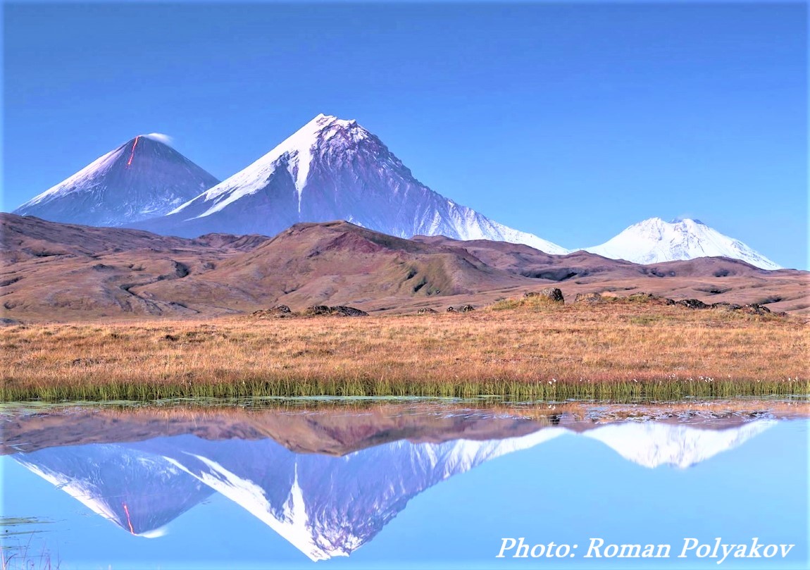 Nalychevo Natural Park Nalychevo Natural ParkArea 287,000 hectares Location: the park territory is situated 25 kilometers northward of Petropavlovsk-Kamchatsky. Nalychevo is one of the first nature parks on Kamchatka (after the name of the river and valley Nalychevo). At present this park is officially registered and entered in the UNESCO World's Inheritance List. Many rare geological phenomena concentrate here in a small space. This is a unique place to observe and study volcanic activity, ancient and modern ore and hydrotherma forming processes. The active volcanoes are centers of mighty modern glaciation. Tarn glaciers are forming in cirques of ancient extinct volcanoes.
Nalychevo Valley is surrounded with always snow-topped volcanoes of the Avachinskaya and Dzendzurskaya ridge. The whole valley is covered with brushwood of Kamchatka's stone birch, alder thickets, elfin wood, and the river Nalychevo with tributaries and hot springs worked its way there. The territory of the nature park Nalychevo has complicated geological structure. Combination of modern volcanic landscapes and ancient glaciers, some specific microclimatic conditions of the Nalychevo river valley have created an abundance and diversity of plant and animal life. Of special interest is vegetation formed in thermal water bodies and nearby. Erman (stone) birch woods, typical for Kamchatka, are unique in the vicinity of the springs because rare species of orchids family are unusually found here including adorably beautiful large flower ladie's slipper, registered in the Red Book of Russia. The animal life is represented with 33 species of mammals. The largest animals are bear, wild reindeer, and snow sheep. The Nalychevo river valley is a site of seasonal aggregation of brown bear during salmon spawning and berries ripening period. Volcano slopes and rocks of Nalychevo cape are snow sheep habitation places. The list of birds counts 145 species (including 90 nesting). Specially protected species are Pacific brant, Steller's sea eagle, sea eagle, Arctic falcon, peregrine falcon, golden eagle. Five species of Pacific salmon spawn and have great numbers in the Nalychevo river and its tributaries. Rare species of char and Kamchatkan trout are found here. 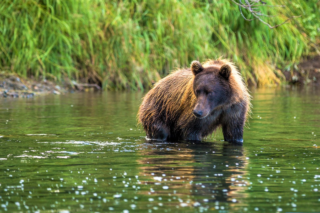 Bystrinsky Natural Park Bystrinsky Natural ParkArea 1,325,000 hectares Location: the central part of Kamchatka Krai, max. length from the north to the south is 142 km.
Created in 1995, in 1996 the park was included in the UNESCO World Natural Heritage List.
The park’s significance lies in the primeval, virtually unchanged natural landscapes, dominated by alpine relief and larch forests, and also in the preservation of the traditional ways the indigenous people use natural resources here. The main thing in the park is, first of all, its grand virgin landscapes of Sredinny Range, taiga forests and their animal life and, of course, traditional way of life of local indigenous people - Evens. Tens of volcanoes (including active Ichinsky volcano 3,607 m or 11,834 ft) and multiple thermal springs are located here. 7 groups of natural hydrothermal springs with different chemical constitution and temperature are located in the Sredinny Range area. The springs are popular with the locals because of their medical qualities and are used for bathing and healing. Besides, thermal water is used for heating houses and greenhouses. A number of vegetation and animal communities, typical for Kamchatka, many of which are little studied and endangered, can be found in the park. The peculiarity of the park’s land mammal fauna can be seen in the combination of forest, tundra and mountainous forms. The characteristic common species are brown bear, sable, river otter, bighorn ship, elk, arctic hare, northern pika, squirrel and black-capped marmot. The bird population consists of true taiga-dwellers, originally associated with coniferous forests, as well as of common dwellers of Kamchatka leaf forests. Predatory birds are especially valuable. The bird diversity in the basin of the Kamchatka River is the greatest on the peninsula. Indigenous people of the North living within the boundaries of the park and leading traditional life style make Bystrinsky Nature Park really special. The centers of preservation and cultivation of indigenous culture are Esso (translated from the Even language as “larch”) and Anavgai villages. There is an ethnographic museum in Esso settlement. One can see unique domestic and cultural items of Kamchatkan aborigines there. An exhibit center with national souvenirs shop works under the museum. Kurile Lake is one of the most remarkable spots in the Sanctuary. Located on wild rocky shores and bordered by impenetrable shrubs, the lake measures 12.5 km by 8 km. This is the deepest lake in Kamchatka, with a depth of 316 m.
The lake is surrounded by a number of both dormant and active volcanoes. The most picturesque of these volcanoes is the Ilyinskaya Sopka (1,577 m high). A stunning bay formed at its base, the result of lava flow following an eruption, which reflects the volcano in its glassy waters. The lake is the largest spawning ground for Pacific sockeye salmon in Eurasia. From July to September, hundreds of thousands of fish come to the Kurile Lake along the Ozernaya River. The most massive gathering of bear fishing takes place here. Several dozen animals congregate on the lake as well. Visitors can watch the bears from a special observation tower nearby. Bears pay little attention to tourists and are more interested in fishing, raising their babies, fighting, and just relaxing. TOUR SIGHTS OF INTEREST
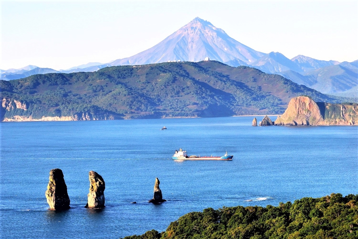
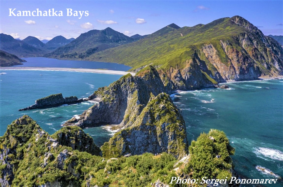
Avacha Bay is the main sea gate of the Kamchatka Krai covers a huge area of 215 sq. m. This is the second largest bay in the world and the largest in the Northern Hemisphere. Its shores are surrounded by rocks and hills, while in the west, the rivers of Avacha and Paratunka flow into it. When heading from Avacha Bay, there are three oddly-shaped, massive rocks known as the Three Brothers, poking out of the water. According to legend, these are three mighty brothers who defended locals from huge waves. However, after they prevented the catastrophe on the shore, the brothers turned to stone and became eternal guardians of the bay.
Klyuchevskaya Sopka is the most famous volcano of Kamchatka and the largest active crater in Eurasia (4750 metres). This beautiful and magnificent volcano is recommended for climbing only with an organised group of experienced mountaineers. You will need a special permit to ascend Klyuchevsky Volcano. What is more, participants need to be in good physical shape as they will have to cover up to 20 km uphill and downhill in one day. The route might be complicated by rockfalls and sloughing. The coast line of Khalaktyrsky Beach is covered with black sand which is fine-ground volcanic rock from the nearby volcanoes. It is windy here all year round, while the wave height can reach 10–15 meters. When the water gets low, the sky and the clouds are reflected in the black sand. It is quite easy to get to the beach, which is popular with surfers and those who love picnics by the water. The Commander Islands are inhabited by animals who are not afraid of humans. Here you will have a chance to observe rookeries of fur seals and eared seals, watch colonies of birds and take pictures of migrating whales. June to September is the perfect time to visit the islands. Ethnographic Museum in Esso there you can find out much about the history of the area’s peoples in a charming Cossack-style izba (wooden house) set beside the rushing river that flows through Esso. The museum contains some truly memorable old photos. In addition there is a specially built defense tower, a Koryak semi-basement dwelling, and a booth, an exhibition hall in the museum.
Our Kamchatka Mass Media digest:
Tatiana Morina, a journalist, travelled to Kamchatka in summer 2016 as part of a project to help out at the Bystrinsky Nature Park. She spent three months in the great outdoors working as a volunteer to create a map of routes for future park visitors. Bystrinsky Park is the largest and the least visited sanctuary in Kamchatka. It is best known for its reindeer breeders, who live and work in the tundra of central Kamchatka. There are no erupting volcanoes, geysers or huge spawning streams here, but the local landscapes are spectacular and unrivalled by any other in Russia or the world.
A journey to the heart of the peninsula
Our work started in Esso, the administrative centre of the district. Our first task was to find a path to Lake Blyudtse ("Saucer"), located on one of the Kozyrevsky Range peaks. We spent five days climbing the ridges, enduring stormy winds, making our way through impassable thickets of Siberian dwarf pines, descending from cliffs and following bear trails, which led to inevitable encounters with some of Kamchatka’s most famous residents.. to continue click here
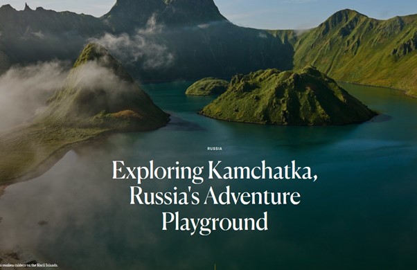
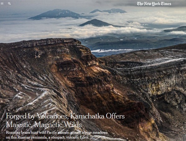
by Eva Sohlman and Neil MacFarquhar for NY Times “If you can find me a better place than Kamchatka on this earth, I will argue with you!” exclaimed Alexei Ozerov, the exuberant chief volcanologist on the entrancing peninsula hanging off Russia’s Pacific Coast. Leaping from behind his cluttered desk at the Institute of Volcanology and Seismology, he tore a tabletop globe from its stand and traced his finger around the “Ring of Fire,” the chain of volcanoes encircling the Pacific Ocean. Only the Kamchatka Peninsula stands directly over the grinding tectonic forces that forged its volcanoes, he said, with about 30 still active among more than 300. Four to seven erupt annually. That makes it a unique vantage point for volcanologists and everybody else, said Mr. Ozerov. Unesco seemed to agree. The international organization has designated the volcanoes of Kamchatka a world heritage site because of what it called their exceptional beauty, concentration and variety. Indeed, say “Kamchatka” to a Russian, and many will respond with a dreamy look and a wistful “Oh!” The peninsula, farther east than Japan, represents a distant otherworld of majestic, magnetic wilderness.
to continue click here From the moment you arrive in Kamchatka you’ll be swept up by a Scandinavian-like atmosphere: Ascetic houses with a cool ocean in the background, long winters, hot water springs and geysers, snow scattered with volcanic ash and Erman’s birch trees. These trees, better known as stone birch trees and ubiquitous throughout the peninsula, are the only trees that cannot be broken by even the strongest of northern winds. If you combine all of these elements, I think you’ll quickly understand why Kamchatka has more in common with Iceland than much of Russia’s Far East. How does one of the remotest and least accessible of Russia’s regions attract tens of thousands of tourists every year despite the high prices and difficult logistics? 1. Bears
Kamchatka is the real “bear state” of the Russian Federation. According to various estimates, there are between 15,000 and 30,000 bears here. Such a high concentration of bears cannot be found anywhere else not only in Russia, but in the whole world. The safest and most impressive place to observe Kamchatka’s bears is at Lake Kurile (200 kilometers from Petropavlovsk-Kamchatsky). to continue click here
On a map, the Kamchatka Peninsula is the part of Russia that curls into the upper northwest Pacific like a dog’s ear. At its southern tip, it peters out into the Kuril Islands, also known as the Fog Archipelago, which scatter down into the Sea of Okhotsk just northeast of Japan. to continue click here
|
|
World time
--:-- :--
--.--.--
Our TOURS by CategoryOur Special ServicesSearch
Send an e-mail:
|
language: ENG / RUS
© All rights reserved by Absolute Siberia LTD.
   |
Weather in Irkutsk
Our NEWS 25.02 2015 15.05 2013 Our Associated Organizations
|
||||||||||||||||||||||||||||||||||||||||||
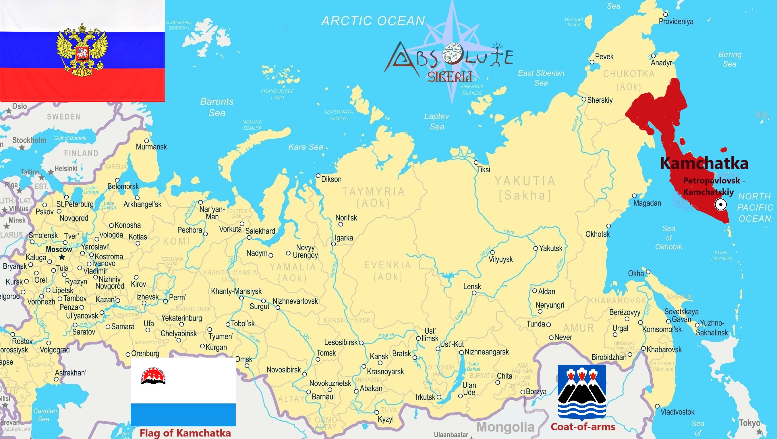
 Kamchatka krai (Kamchatsky) is a federal subject of Russia located in the Far East of the country, in the Far Eastern Federal District. The territory was founded in 2007 when the Kamchatka oblast (region) was merged with the Koryak autonomous okrug (district). The territory includes the entire Kamchatka Peninsula and the southern end of the Koryak Mountains. The administrative center is Petropavlovsk-Kamchatsky.
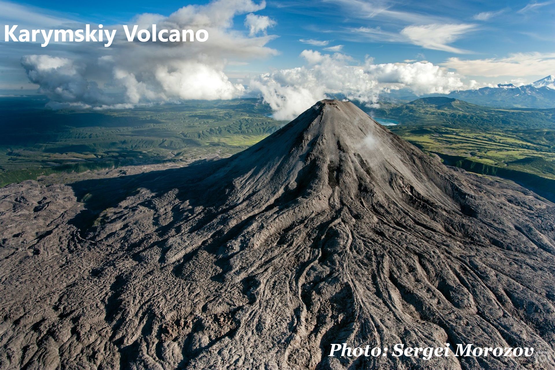
 Impressive photos with domestic volcanoes in the background can be taken without even leaving Petropavlovsk-Kamchatsky. The city is surrounded by volcanoes which were nicknamed "Domestic" by locals for their proximity to the region's capital. Avachinsky is the most well-known and popular volcano. This is a 2741-m high active volcano. The same group includes the Koryaksky, Kozelsky, Aag and Arik volcanoes.
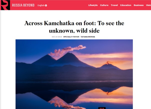
 “
“