BURYATIA Republic Profile
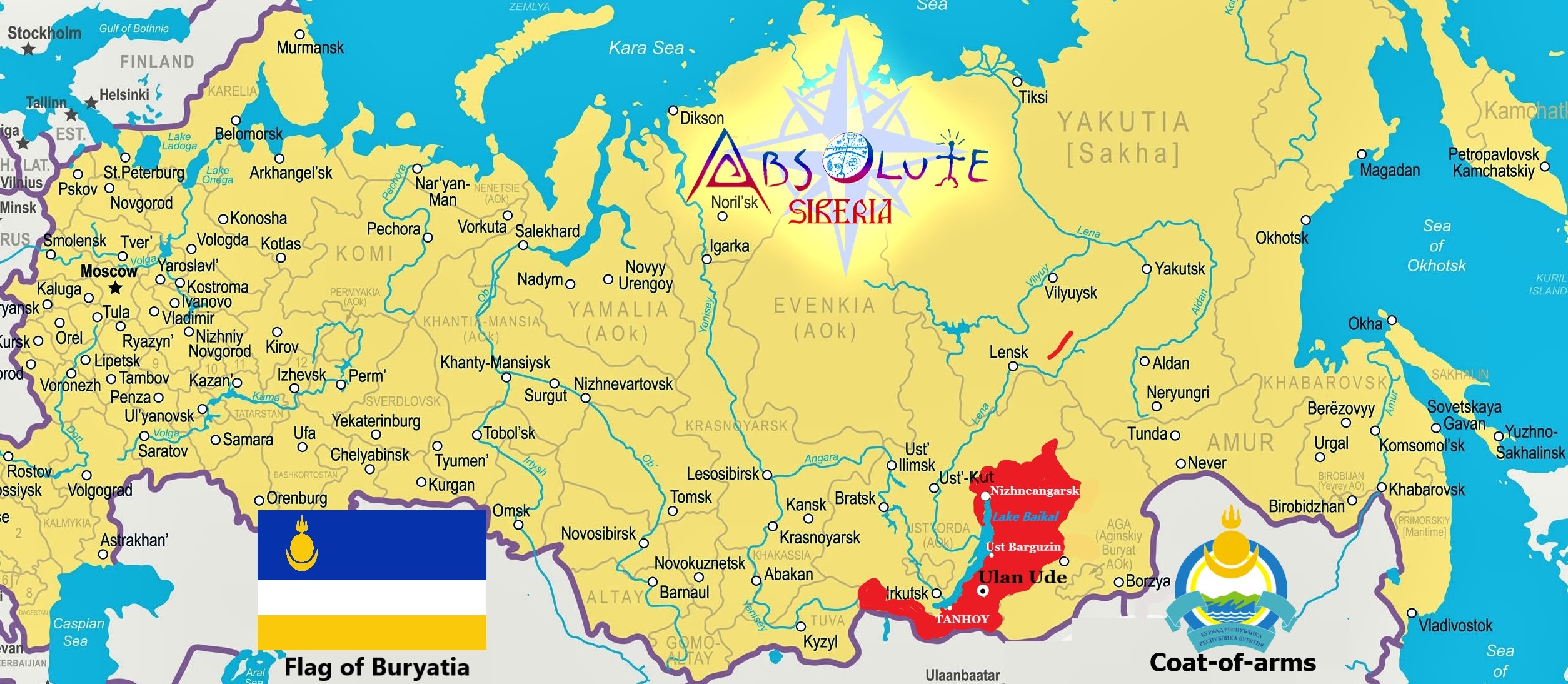
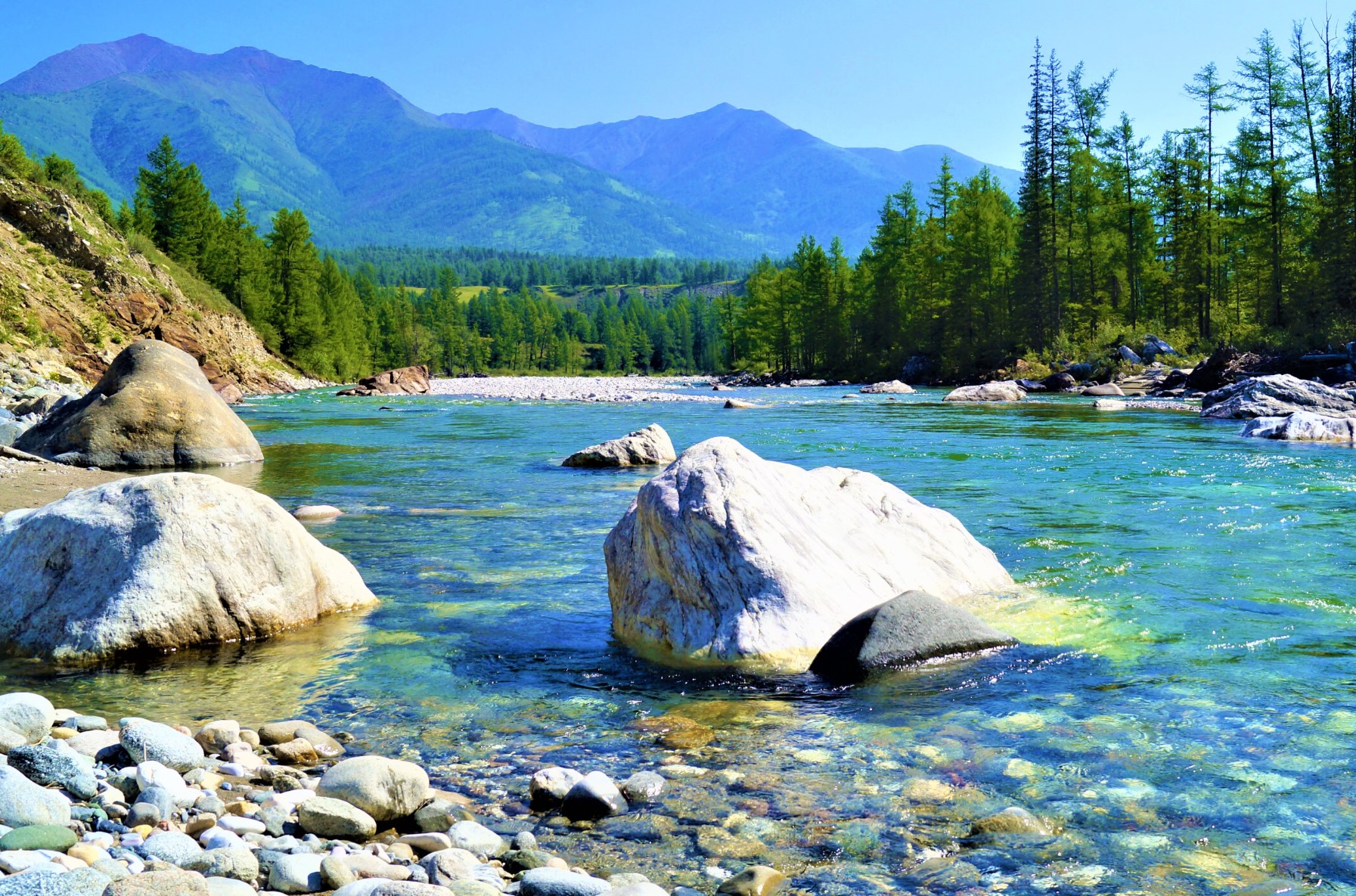
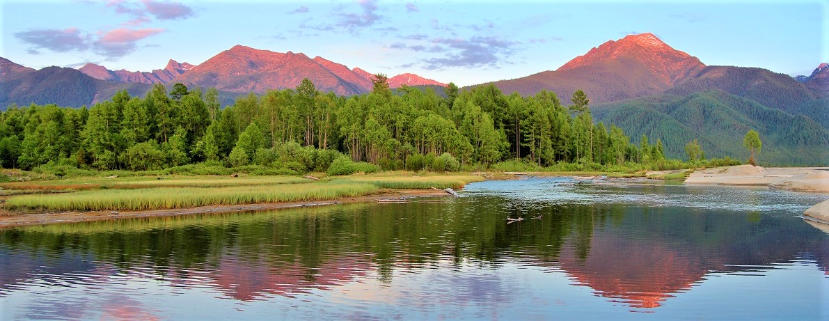
The Republic of Buryatia is located in the south of Eastern Siberia; its territory takes up two thirds of the water area of Lake Baikal and spreads for 600 km from north to south, and for 420 km from west to east. The terrain is predominantly mountainous, with a small number of plains located at an altitude of over 500 m. Buryatia consists of a complex of mountain ranges, plateaus, basins, and river valleys. It includes the Sayan Mountains in the panhandle, which rise to over 10,000 feet (3,000 meters); the Khamar-Daban Range, which rises from the southern end of Lake Baikal; the Barguzin Mountains, which parallel the lake’s northeastern shore; the Vitim Plateau in the northeast; and the Yablonovo Range on the republic’s eastern border. The chief river systems are the Selenga, a navigable river flowing into Lake Baikal, and the Vitim, a northward-flowing tributary of the Lena River. Thick, poorly drained forests, or taiga, mostly of conifers, cover 70 percent of Buryatia’s area, while in the intermontane basins and valleys, steppe vegetation prevails. Poor soils predominate in the taiga, but fertile black earths can be found in the steppe regions. Buryatia borders on the Republic of Tyva, the Trans-Baikal Territory, and the Irkutsk Region, and has a state border with Mongolia. CAPITAL: Ulan – Ude (settled in 1666 by the Russian Cossacks, population 404,426 people, 5,640 kilometers (3,500 mi) east of Moscow and 100 kilometers (62 mi) southeast of Lake Baikal) AREA: 351,300 sq km (218,287 square miles) POPULATION & NATIONALITIES: 985 937 as for 2020, 55th in Russia by population, ethnically
according to 2010 National Census Russian – 66.05 %, Buryat – 30.04 %, Other – 3.91 %. CLIMATE The Republic of Buryatia territory is characterized by a sharply continental climate with large annual and daily fluctuations in air temperature and with uneven distribution of atmospheric precipitation for the seasons of the year (January temperatures average –24.3°C and its absolute minimum is 45-55 degrees below zero. July temperatures average 17.4°C). Low winter temperatures are easily tolerated because of the dry air. Summer heat is felt only at noon hours, and the morning and evening time of the day are pleasant with its coolness. Autumn is long and quite warm - until Baikal freezes. The air temperature in Buryatia is often higher at this time of year than in the European regions of the country. The Siberian spring begins at the end of March, but the first green grass breaks at the end of April. The lowest temperatures occur in river valleys and basins, where stagnation and intensive cooling of air takes place. In general, the climate is formed under the influence of three contrasting components: the dry and cold climate of the northern regions, hot and dry Mongolian deserts and the humid Pacific climate. HISTORY The territory of Buryatia has been governed by the Xiongnu Empire (209 BC-93 CE) and Mongolian Xianbei state (93-234), Rouran Khaganate (330-555), Mongol Empire (1206-1368) and Northern
Yuan (1368-1691). In the 16th century, the Russian empire began intensively expand its borders to the east. Major historical events, advancing towards Baikal, touched the fate of the peoples who lived in these territories. In 1666, on the high bank of the river Uda, the Russian Cossacks built a wooden fortress, which laid the foundation for the large merchant city of Verkhneudinsk, which later became the capital of Buryatia, Ulan-Ude. The establishment of stable borderlines by Russia led to the isolation of the Buryat tribes from the rest of the Mongolian world. The tsarist government established its administrative and management system in Transbaikalia, but internal self-government was carried out by the Buryat nobility under the control of the East Siberian administration. The construction of the Trans-Siberian railway, passing through the territory of the Trans-Baikal region, as well as the traditional caravan routes linking Russia with the countries of South-East Asia, led to intensive economic development of the region in the 18-19th centuries. In 1923, The Buryat Autonomous Soviet Socialist Republic was formed.
The capital of Buryat-Mongolia in 1934 was renamed Ulan-Ude. In 1937, a number of districts were withdrawn from the republic, based on which two Buryat autonomous regions were formed, which were part of neighboring regions: Aginsky within the Chita and Ust-Ordynsky districts in the Irkutsk region. In 1990, the state sovereignty of the Buryat Soviet Socialist Republic was proclaimed and the renunciation of the status of an autonomous republic was declared. In 1991, the parliament of Buryatia excluded the definition of "Soviet" and "Socialist" from the name of the republic, and it received a modern name. NATURE PRESERVES / WILDLIFE SANCTURIES
Tunka national Park
Area 1,183,662 hectares (11,837 km2; 4,570 sq mi)
Location Tunkinsky District of the Republic of Buryatia Tunka Valley extends from the southwestern part of Lake Baikal in east-west direction for more than 200 kilometers. In the south, the valley is flanked by the Khamar-Daban ridge, in the north it is bounded by the Tunkinskie Gol’tsy, a mountain range that owes its name to the treeless, “bald” (golyi) appearance of the mountain tops. The valley is a link in the chain of tectonic subsidence, composing the Baikal rift zone. The area is characterized by extreme continental climate with large daily and annual temperature amplitudes (average temperature in July is +14°C, in January -24°C) and low values of average precipitation. The region’s flora includes over 1,000 species of vascular plants, including 68 species listed in the Red Data Book of Buryatia and the Red Data Book of the Russian Federation. Many plants growing in the park are medical, which leads to a problem of control over plant collectors. All forests in the national park are classified as belonging to “group one”, which is the highest protection category in Russian forestry. Siberian cedar and larch are dominant tree species. On the southern slopes and at the bottom of the valley, steppe areas are abundant; in the western part adjacent to Mongolia, there are alpine steppe complexes. Floodplains and other lowland areas are occupied by thickets of shrubs, meadows, wetlands, and swamps. Typical for the mountain ranges are the Siberian mountain goat, black-capped marmot, with traces of the snow leopard. The southern slopes and the bottom of the valley provide good conditions for animal husbandry, with sheep, cattle, and horses being the main species. The diversity of game and fish is threatened by illegal hunting and fishing, which is the subject of extensive debates in the region.
Barguzinsky State Biospheric Nature Reserve Area 2,482 km2 (958 sq mi) Location The reserve is located on the western slopes of the Barguzin Ridge, at an altitude of 2,840 meters above sea level, and includes the north-eastern coast of Lake Baikal and a part of the lake itself. The ridge and the Reserve got their names from the Barguzin River.
The Barguzinsky Reserve is the oldest of its kind in Russia, and in the past it has played a major role in saving a valuable fur animal, the Barguzin sable, from complete extinction. This is also the only nature reserve to have received the status of a state reserve in the times of the Russian Empire. The reserve is considered to be a benchmark of pure and virgin nature of the mountains and taiga areas near Lake Baikal. The reserve can be seen to have been established in 1916, when the governor-general of Irkutsk issued a decree to that effect. In 1986, the Barguzinsky Reserve was granted the status of a biosphere reserve and was included into the International Network of Biosphere Reserves by UNESCO. This reserve is a part of the Lake Baikal World Heritage Site, along with other nature reserves and national parks belonging to the «necklace of reserves» (Barguzinsky, Baikalsky, Baikalo-Lensky Reserves and the Trans-Baikal National Park). It is located a considerable distance of human impact, so the level of the pollution of air, water, soil, and snow in the reserve are some of the lowest in the country. However, this is what makes this mysterious land fascinating and attractive for sophisticated travelers. The reserve protects all natural systems. The animals living in the territory number a total of 41 species, including moose, musk deer, varying hare, brown bear, shrew, and black-capped marmot. The waters are inhabited by Baikal omul, whitefish, sturgeon, grayling, salmon, flax, and other species of fish. The most famous tourist destinations in include, for example, the valley of Shumilikha River with mountain lakes, and the Karasevoye and Khariusovoe lakes. Tourists who come to the reserve visit Cape Monakhovo, the hot springs in Zmeyevaya Bay, the Chivyrkuysky Gulf, and the Davsha settlement. Those who prefer active leisure climb to the summit of the Holy Nose Peninsula and the pass over the Barguzin Ridge. Lake Baikal
Area Surface area 31,722 km2 (12,248 sq mi).
Location The lake is located at an elevation of almost 500 m above sea level.
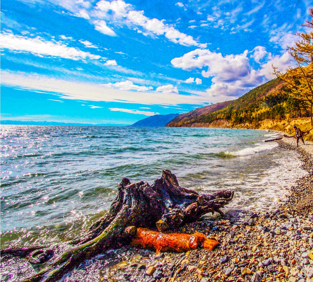
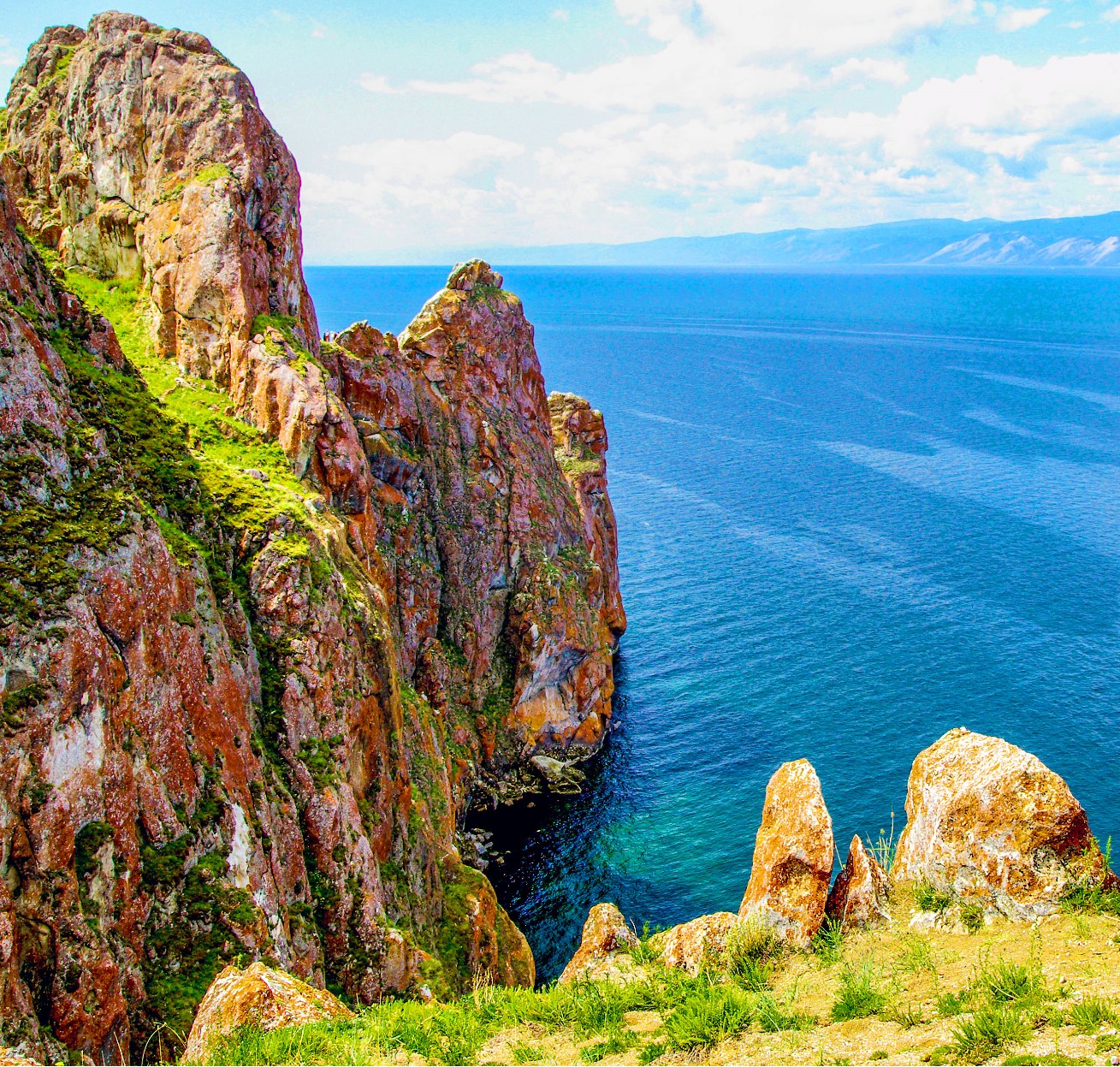 Lake Baikal is the deepest and, possibly, the most ancient lake in the world; it is about 25 million years old. It holds almost a quarter of the world's supply of fresh water, and the water is extremely pure and clear. A white disk 30 cm in diameter can be seen through the Baikal water even at a depth of 40 meters. Lake Baikal is the deepest and, possibly, the most ancient lake in the world; it is about 25 million years old. It holds almost a quarter of the world's supply of fresh water, and the water is extremely pure and clear. A white disk 30 cm in diameter can be seen through the Baikal water even at a depth of 40 meters.Lake Baikal and its shores are home to 1,850 species of animals and 850 species of plants, many of which can only be found there. The most famous Baikal fish are the sturgeon, grayling, cisco, and live-bearing oilfish. However, the most valuable of them all is the omul, revered for its exquisite, tender taste. The lake offers more sunny days than resorts on the southern seas. In the fall, storms with strong winds are frequent. Lake Baikal freezes over only in the second half of January and is completely free of ice only in May. Baikal ice, like its water, is surprisingly clear, forming enormous, transparent fields; in shallow areas the bottom and underwater inhabitants can be seen. Over three hundred rivers fall into this fresh-water storage of the Earth, and only one — the Angara — has its source there. At the outflow, near Listvyanka Village, 70 km from Irkutsk, a stone towers above the water. According to the legend, Father Baikal threw this rock after his disobedient daughter, the beautiful Angara. Despite her father's admonitions, she went to her fiancée, the Yenisei, after moving apart the mountains surrounding the lake. Lake Baikal is a true tourist magnet. Most come in the summer, a relatively warm season there. In late July — early August, the water near the shores heats through well. It is best to travel about the lake on a small rental boat, being able to change the route at one's discretion, enter the picturesque harbors and straits, fish, and sunbathe. The Olkhon Island is a power center of sorts of the area. It is called the Heart of Lake Baikal; even its shape is reminiscent of the outline of the lake. It is the largest island on Baikal, 71 km long and 12 km wide. The deepest spot of Lake Baikal is near the north-western bank of the Olkhon (1,637 m). Locals believe that the grave of Genghis Khan is located in the cave of the Burkhan marble cliff. TOUR SIGHTS OF INTEREST
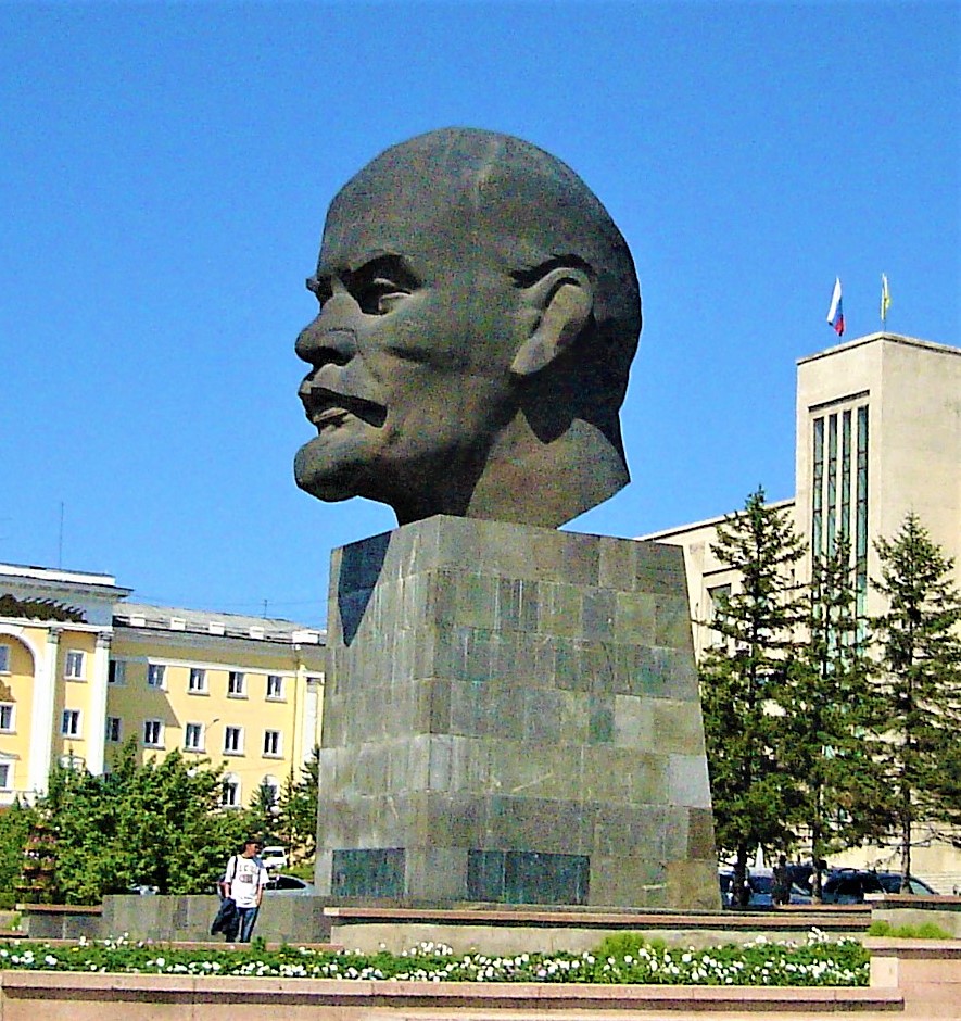 Lenin’s monument is one of the most interesting monuments of Ulan-Ude is standing on the main square of the city (Soviets Square). It is made in the form of the giant head of Vladimir Lenin. It was constructed in honor of the centenary of his birth in 1970. The huge bronze head of Lenin remains a weighty legacy of the Soviet times – it weighs some 42 tons and is 13,5 meters high. It’s the biggest sculpture of Lenin’s head in the world and is one of the local meeting places. Lenin’s monument is one of the most interesting monuments of Ulan-Ude is standing on the main square of the city (Soviets Square). It is made in the form of the giant head of Vladimir Lenin. It was constructed in honor of the centenary of his birth in 1970. The huge bronze head of Lenin remains a weighty legacy of the Soviet times – it weighs some 42 tons and is 13,5 meters high. It’s the biggest sculpture of Lenin’s head in the world and is one of the local meeting places.The Ethnographic Museum of Buryatia is one of the Russian largest open-air museums (37 hectares). The museum has historical findings from the era of Huns, including a unique collection of wooden architecture of Siberian people (more than 40 architectural monuments). The exhibition of the the Ethnographic museum is divided into several complexes: Evenks, Prebaikalian Buryat, Transbaikalian Buryat, Russian Cossacks, Old Believers, Old Verkhneudinsk, and Wildlife Park. The exhibitions are arranged in chronological order so that guests can see the development of the region. Visitors can stroll through the museum looking inside yurts and tepees, viewing interior, all kind of house equipment, wooden tools and utensils. The Ethnographic museum has a small zoo where one can see wolves and bears, roe deer and reindeer, tigers and elks, sables and other animals. Another distinctive feature of the museum, which makes it stand out from the great mass of similar museums in the world, is a variety of performances taking place there: festivals and celebrations, national holidays and sport events. Although the monument Tsar Gates in the center of Ulan-Ude might look old, it was built in 2006. It’s a replica of the 19th century arch built by the merchants to commemorate Tsesarevich Nikolay II, who visited Verhneudinsk during his trip to Siberia. The original arch was destroyed during the Soviet era. The new one is bigger than the original, nevertheless it is an exact copy of the old arch. Arshan Settlement is situated in the foothills of the Eastern Sayan Mountains, where the Kyngyrga river flows down from the mountains. Kyngyrga is translated as «drum» from the Buryat
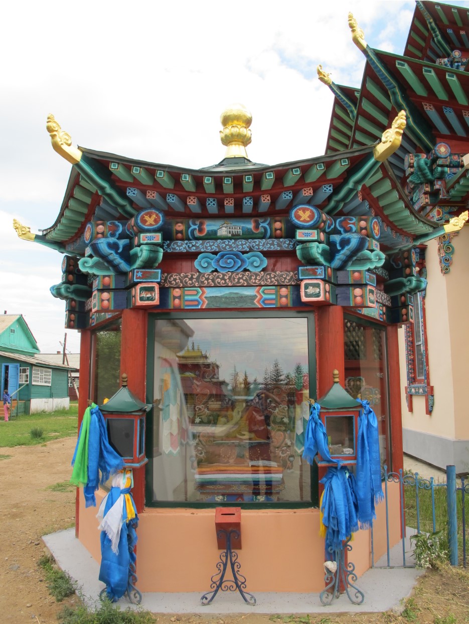
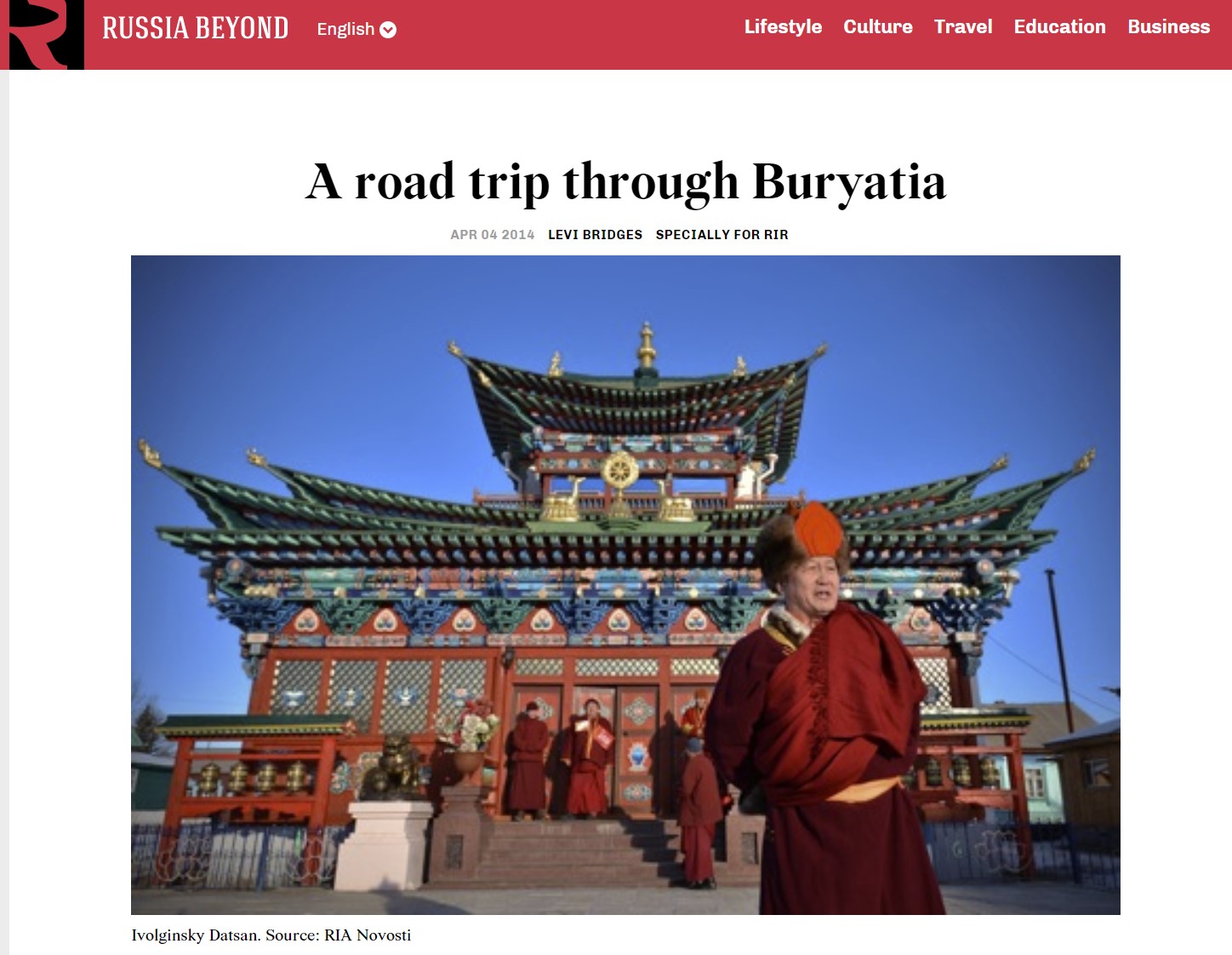
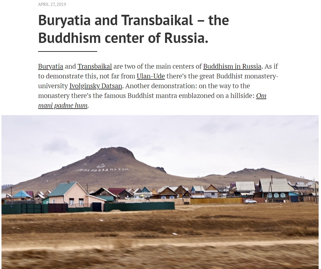
language. This mountain river runs in a narrow, winding gorge with beautiful waterfalls. Arshan water is used for treating diseases of the cardiovascular system, gastrointestinal tract, liver and biliary tract, as well as metabolic diseases and functional disorders of the nervous system. The treatment gives a high therapeutic effect. Using fresh water is most efficient. The Arshan and Sayan sanatoriums, and the Baikal Workers Union Resort are the largest medical and health institutions. Near the resort, there are several attractions accessible by hiking trails. Some places can be reached by car. Tourists can take a short horseback ride. There are two datsans with Lama healers and astrologers in the village. Ivolginsky Datsan, the spiritual capital of the Buddhist traditional Sangha of Russia, is located at the foot of the Khamar-Daban, in the vast steppes, in a quiet area 30 km from Ulan-Ude. Founded in 1945, Ivolginsky Datsan is currently referred to as the spiritual capital of Russian Buddhists. It is also the largest Buddhist complex in Russia. Its construction began the history of the revival of Buddhist tradition in Russia, following its almost complete destruction in the first decades of the Soviet era. Ivolginsky Datsan is a monastery complex consisting of eight buildings, including temples, a library and Russia’s only Buddhist university where students study philosophy and traditional Tibetan medicine. The Datsan is famous outside of Russia, not only for the contemporary spiritual education it provides, but also because of the name Dashi-Dorzho Itygelov, the leader of Russian Buddhists in the early 20th century and an associate of the 14th Dalai Lama. Ethnotourism Village of Tarbagatay, Russia, is one of the largest surviving communities of Old Believers, religious dissenters who were violently repressed and twice exiled by the czars. They finally found refuge amid the wilds of Siberia 250 years ago. Seventy years of Communist repression nearly finished them off, but since the Soviet Union’s demise they have been painstakingly reviving the unique medieval traditions of prayer, song, cuisine, dress, and handicrafts that are now protected by UNESCO as “Intangible Cultural Heritage.” They’re restoring their once-shattered communities. In order to visit the Evenks, you will have to go far to the North of Buryatia, where there is even a separate Evenki Bauntovsky district. Of course, the Evenks were touched by globalism. No one lives in the plagues anymore, but many have returned to reindeer herding. Tourists here will have the opportunity to feast on game, buy kumolans (carpets made of pieces of fur) and boots made of deer fur.
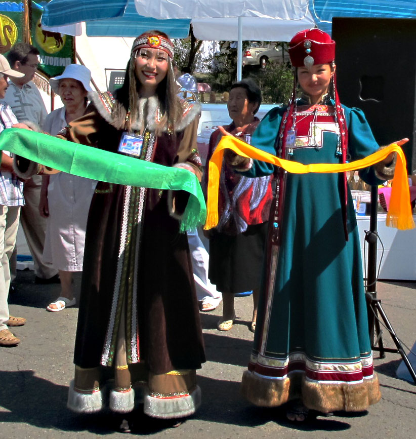
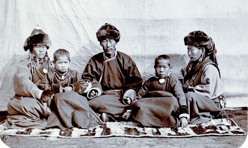
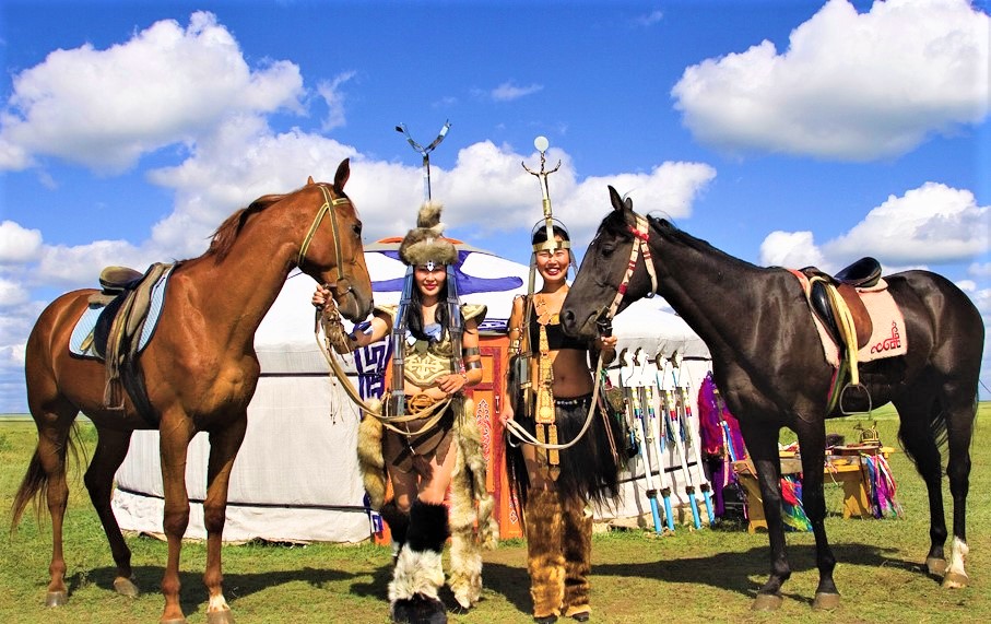
CULTURE The first distinctive feature that strikes the eye of foreigners is the fact that the Buryat culture is full of colors. They are actively used in their religious practices and every color has its special meaning, even the fabrics used for a Buryat traditional costume are also very bright and vivid. Also the Buryats believe that everyone has their own color which is assigned to a person according to his or her birth year. Traditional Siberian hospitality is also worth mentioning. You can see all cultural peculiarities yourself during a visit to an ethnic Buryat village and the Russian Old-believers’ Village which are absolute “musts” for all guests of Buryatia. Don’t miss the opportunity to get an insight into the fascinating character and lifestyle of the local people, treat yourself with delicious organic Buryat food (cooked according to ancient recipes), and let yourself be enchanted by unusual Buryat music, filled with sounds of the wild wind. Buryatia is the place where numerous different religions and cultures have developed side by side for centuries, including Buddhism, Shamanism, Russian Orthodoxy, and Old-Believer Christianity. The Buryats' religious systems were led by shamans and were originally based on the deification of nature, belief in spirits, and their magical powers. Shamanism and Buddhism play the most important role in the present-day Buryat belief system. The Buryats from the south part of the region are mostly influenced by Tibetan Buddhism while Shamanism is more developed in the west. However, over the course of history, these two religious systems adopted many features and aspects of each other, such as colorful ribbons and material tied to branches and sticks symbolizing prayers. Going to Lake Baikal, you are surely going to encounter trees covered in multicolored ribbons, so now you know that this is more than just an element of decor.
Our Buryat Republic Mass Media digest below:
|
|
World time
--:-- :--
--.--.--
Our TOURS by CategoryOur Special ServicesSearch
Send an e-mail:
|
language: ENG / RUS
© All rights reserved by Absolute Siberia LTD.
|
Weather in Irkutsk
Our NEWS 25.02 2015 15.05 2013 |


 LOCATION & GEOGRAPHY
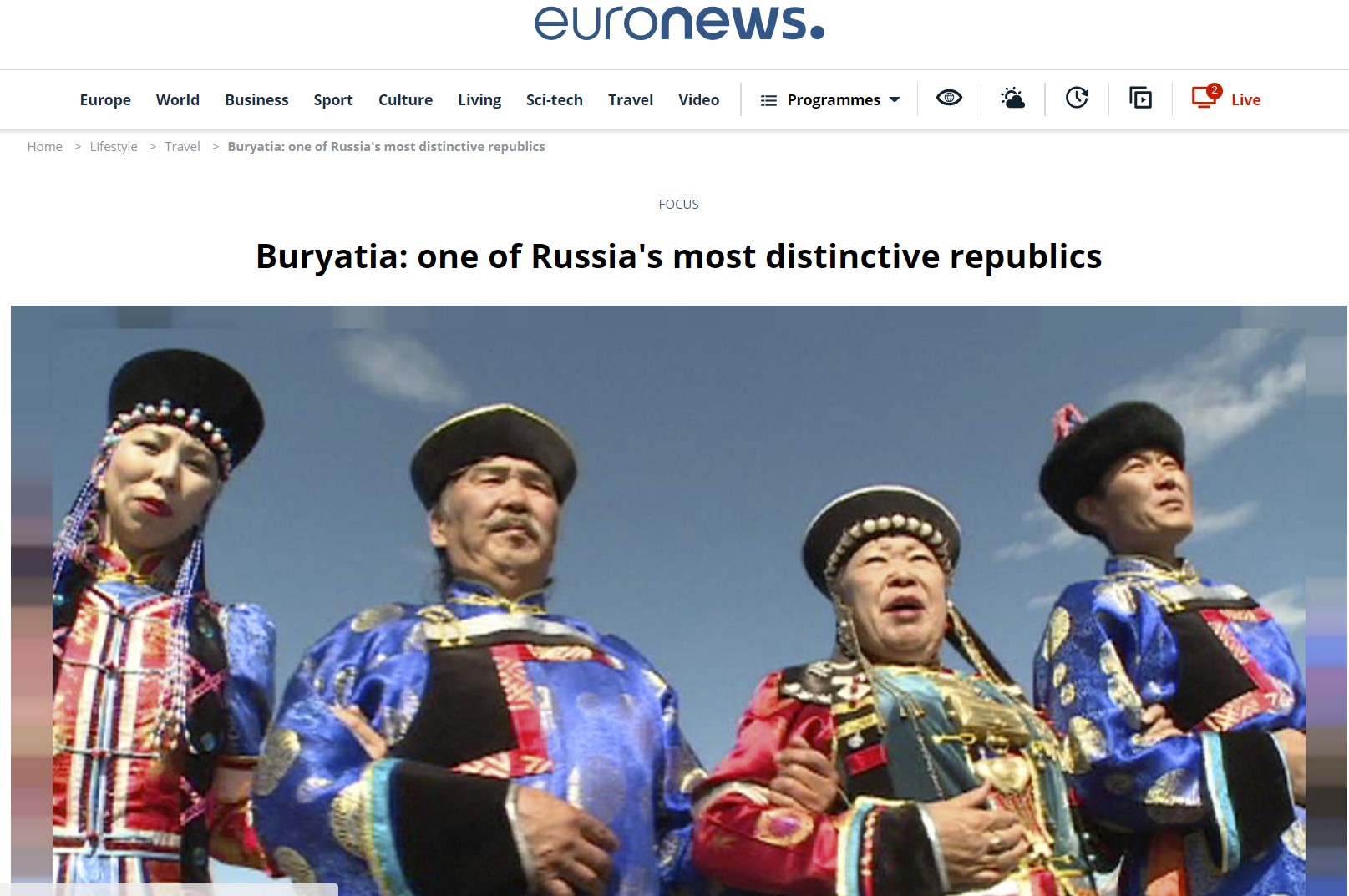 “Buryatia: one of Russia's most distinctive republics” by Euronews
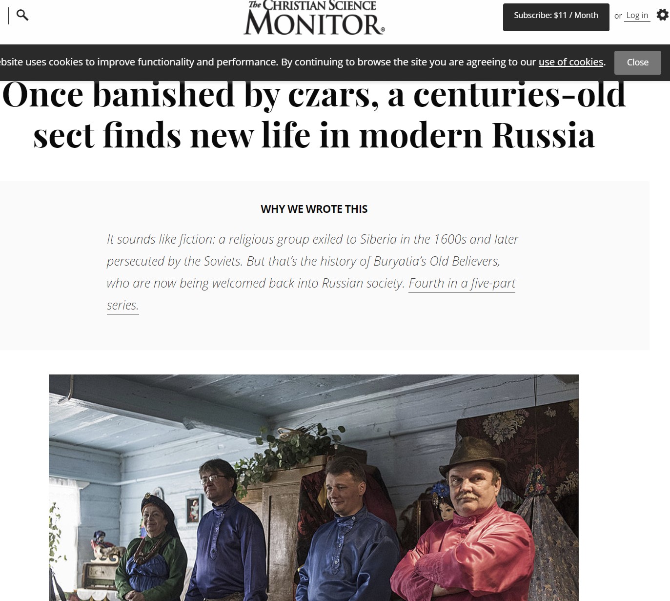 “Once banished by czars, a centuries-old sect finds new life in modern Russia”


